 Canada Journal – News of the World Articles and videos to bring you the biggest Canadian news stories from across the country every day
NASA has announced the start of construction for a revolutionary new satellite-based system expected to drastically improve hurricane forecasts.
Hurricanes can change direction and intensity without warning and what looks like a mild one headed safely out to sea can quickly gain power and turn landward. Unfortunately, current satellite monitoring systems can only look at such storms periodically, which can lead to some nasty surprises.
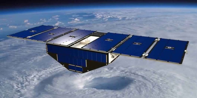
CYGNSS consists of a constellation of eight microsatellites and its purpose is to improve hurricane forecasting. It does this by, for the first time, measuring ocean surface winds in and near the inner core of tropical cyclones, typhoons, and hurricanes throughout their life cycles, thereby providing better predictions of a hurricane’s intensity, track, and storm surges.
Assembly of the first CYGNSS microsatellite started on August 14 under the direction of the University of Michigan, which is providing the satellite design and production, as well as data processing.
Each of the microsatellites weighs 64 lb (29 kg) and measures 20 x 25 x 11 in (51 x 64 x 28 cm), which is about the size of a piece of carry-on luggage. They’re solar powered and when extended, the panels have a span of 5.5 ft (1.6 m). It’s expected that seven of the satellites will be completed in a few weeks.
The CYGNSS constellation will be deployed in low-Earth orbit on a trajectory that will let each one of the string of satellites to pass over a given area every 12 minutes. They use direct and reflected signals from the constellation of GPS satellites to build up an estimated picture of surface wind speeds over the ocean in the eye-wall of the hurricane. Unlike a conventional satellite, which transmits back wind speed readings every few days, CYGNSS has a satellite over the tropics every few hours and the constellation allows for longer reading durations. This allows for a near-continuous monitoring of hurricanes, so sudden changes in direction and intensity are less likely to take the authorities off guard.
The satellites will be stacked for launching and tested early next year before being sent into orbit atop an Orbital ATK Pegasus XL rocket from Cape Canaveral Air Force Station in Florida. It’s hoped that the system will be operational in time for the 2017 Atlantic hurricane season.
Agencies/Canadajournal